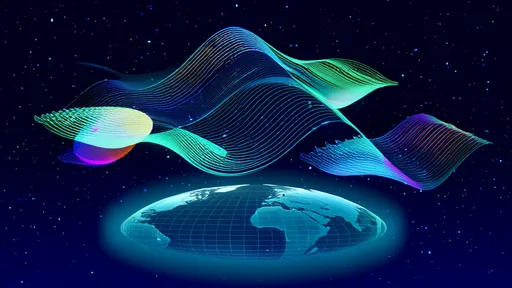
Satellite observations over the past three decades have fundamentally reshaped our understanding of polar ice sheet dynamics, revealing a story of accelerating mass loss with profound implications for global sea levels and climate systems. What was once perceived as slow-moving, largely stable expanses of ice are now understood to be highly responsive to atmospheric and oceanic changes, with melt rates that have consistently outpaced earlier scientific projections. The data, gathered through a combination of altimetry, gravimetry, and imagery from an international fleet of Earth-observing satellites, provides an unambiguous and alarming record of change at the planet’s extremities.
The story of this discovery is inextricably linked to technological advancement. Prior to the satellite era, measurements of the massive Greenland and Antarctic ice sheets were sporadic, localized, and incredibly challenging to obtain. Scientists relied on a patchwork of ground-based surveys and aerial photography, making it difficult to assess the overall health of these frozen giants. The launch of dedicated satellite missions, beginning in earnest in the 1990s, changed everything. Instruments like radar altimeters began meticulously mapping the surface height of the ice sheets, year after year. Later, missions like NASA’s GRACE (Gravity Recovery and Climate Experiment) and its successor, GRACE-Follow On, provided a completely new way to measure ice loss by detecting tiny changes in Earth’s gravity field caused by the movement of massive amounts of ice and water.
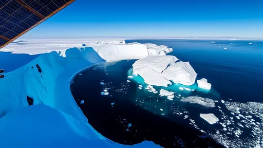
The data streaming down from these orbital sentinels has painted a clear and consistent picture: both the Greenland and Antarctic ice sheets are losing billions of tonnes of ice each year, and the pace of this loss is quickening. In Greenland, the process is dominated by surface melting. Warmer air temperatures cause vast areas of the ice sheet’s surface to melt, forming lakes that can drain to the base, lubricating the flow of glaciers, and calving more icebergs into the ocean. Satellite imagery captures the dramatic expansion of melt zones each summer, while altimetry records the subsequent thinning and lowering of the ice sheet’s surface.
Antarctica presents a more complex and, in some ways, more concerning narrative. While the immense East Antarctic Ice Sheet has remained relatively stable in mass, the smaller West Antarctic Ice Sheet and the Antarctic Peninsula have been undergoing rapid and destabilizing change. Here, the primary driver is not surface melt but rather oceanic melting. Satellites have been crucial in identifying the intrusion of relatively warmer circumpolar deep water onto the continental shelf, where it eats away at the underside of vast floating ice shelves that act as plugs, restraining the land-based ice behind them. As these shelves thin and weaken, their buttressing effect diminishes, allowing glaciers to accelerate their flow into the sea. The thinning and eventual collapse of the Larsen A, B, and more recently, parts of the Larsen C ice shelf, observed in stunning detail by satellites, are stark examples of this process.
The direct consequence of this ice loss is a rising global sea level. When land-based ice melts and flows into the ocean, it adds new volume, a process distinct from the thermal expansion of seawater as it warms. Satellite data has been instrumental in quantifying this contribution. It is now understood that melt from Greenland and Antarctica constitutes a significant and growing fraction of the observed sea-level rise, threatening coastal communities, infrastructure, and ecosystems worldwide. Current projections, which are heavily reliant on satellite observations, suggest that this contribution will only increase throughout the 21st century.
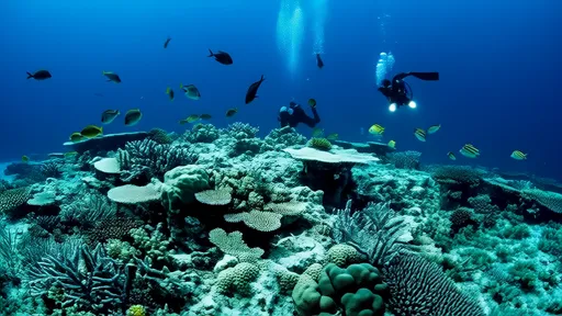
Beyond sea level, the impacts of polar ice loss ripple through the Earth system. The influx of cold, fresh meltwater from Greenland into the North Atlantic has the potential to disrupt major ocean circulation patterns, such as the Atlantic Meridional Overturning Circulation (AMOC), which helps regulate climate in Europe and beyond. In Antarctica, changes in ice sheet mass affect the salinity and stratification of the Southern Ocean, with consequences for global nutrient cycles and marine life. Satellites monitoring sea surface temperature, salinity, and current patterns are essential for connecting these dots and understanding the full scope of polar changes.
Looking ahead, the role of satellite observation is more critical than ever. New and planned missions, equipped with even more sophisticated sensors, will continue to monitor the daily and yearly changes in ice sheet height, mass, and velocity. This continuous record is vital for improving predictive climate models, which are our best tool for anticipating future change and informing policy decisions. The data leaves little room for doubt; the polar ice sheets are not static relics of a colder past but are dynamic and vulnerable components of our modern climate system. Their ongoing transformation, meticulously documented from space, stands as one of the most definitive indicators of a planet in rapid transition.
By /Aug 25, 2025

By /Aug 25, 2025
By /Aug 25, 2025
By /Aug 25, 2025
By /Aug 25, 2025

By /Aug 25, 2025

By /Aug 25, 2025

By /Aug 25, 2025

By /Aug 25, 2025

By /Aug 25, 2025

By /Aug 25, 2025

By /Aug 25, 2025

By /Aug 25, 2025

By /Aug 25, 2025

By /Aug 25, 2025
By /Aug 25, 2025
By /Aug 25, 2025

By /Aug 25, 2025
By /Aug 25, 2025

By /Aug 25, 2025