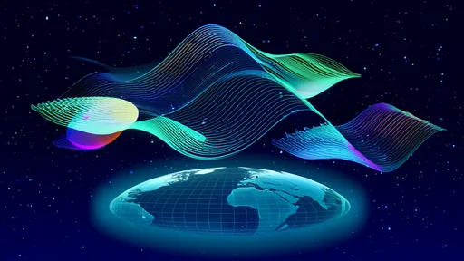
As the global community grapples with accelerating biodiversity loss, the scientific world has turned to increasingly sophisticated tools to monitor and understand these changes. Among these, remote sensing technology has emerged as a transformative force, fundamentally altering our capacity to observe, measure, and analyze life on Earth from a distance. This technological revolution is providing an unprecedented, macro-scale view of ecological systems, offering data that is both critical for conservation and impossible to gather through ground-based methods alone.
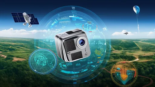
The evolution of remote sensing for ecological applications has been nothing short of remarkable. From the early days of basic aerial photography used for land cover classification, we have moved into an era of hyper-specialized satellites and sensors. Modern systems capture data far beyond the visible spectrum, measuring everything from the chemical composition of the atmosphere to the minute structural details of a forest canopy. Hyperspectral sensors, for instance, can detect subtle variations in leaf chemistry that indicate plant stress or species type, while LiDAR (Light Detection and Ranging) constructs intricate three-dimensional models of vegetation structure, revealing habitat complexity in stunning detail. This shift from simple observation to complex biochemical and structural analysis represents a quantum leap in our ecological understanding.
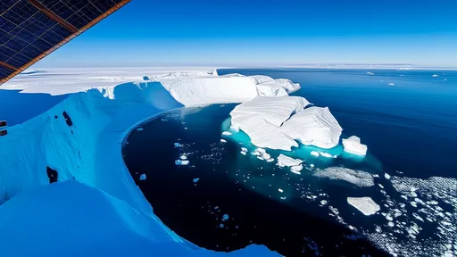
One of the most powerful applications of this technology lies in habitat mapping and monitoring. Satellites can now track deforestation and forest degradation across entire continents with high temporal resolution, spotting illegal logging activities or the spread of wildfires in near-real-time. Similarly, the technology is indispensable for monitoring fragile and inaccessible ecosystems like wetlands, mangroves, and coral reefs. Changes in water extent, vegetation health, and even sea surface temperature can be monitored continuously, providing early warning signs of ecosystem distress. This constant, wide-eyed vigilance from space creates a permanent digital record of change, holding a mirror to both the gradual creep and sudden shocks impacting global habitats.
Perhaps even more groundbreaking is the technology's burgeoning role in observing species populations and their dynamics. While counting individual animals from space remains a challenge for most species, remote sensing excels at identifying suitable habitats and, by extension, predicting species distribution. For larger species or colonial animals, the imagery has become sharp enough to be used directly. High-resolution satellites have been successfully used to count whales, elephants, albatrosses, and penguins, among others. Furthermore, by analyzing environmental variables like vegetation greenness (a proxy for productivity) or snow cover, scientists can make informed inferences about the movement patterns of migratory species and the availability of critical resources, linking animal behavior to landscape-level processes.
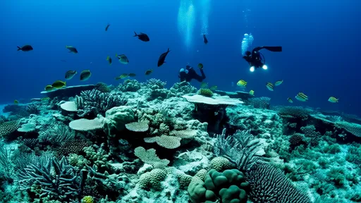
The true power of remote sensing is unlocked when its data is fused with field-based ecological studies. Satellite imagery provides the expansive context—the where and the when—while ground-truthing provides the crucial why and how. Ecologists on the ground collect data on species presence, abundance, and health, which is then used to calibrate and validate the models derived from remote sensing data. This synergy creates a feedback loop: remote sensing guides field teams to areas of interest or change, and field data, in turn, improves the accuracy of the algorithms that interpret the satellite signals. This collaborative approach ensures that the story told by the pixels in the sky is grounded in biological reality.
Despite its immense potential, the path forward is not without significant hurdles. Cloud cover remains a persistent obstacle for optical sensors, particularly in the tropical regions that host the planet's greatest biodiversity. The sheer volume of data generated, often termed "big data," presents another challenge, requiring advanced computational power and sophisticated machine learning algorithms to process and interpret effectively. There is also a pressing need to bridge the gap between the technical remote sensing community and conservation managers on the front lines. The data must be translated into accessible, actionable information to inform policy decisions and on-the-ground conservation actions effectively.
Looking ahead, the future of biodiversity monitoring is intrinsically linked to the advancement of remote sensing technologies. The upcoming launch of even more advanced satellites, the proliferation of drones for hyper-local monitoring, and the rapid development of artificial intelligence for image analysis promise a new era of ecological insight. We are moving towards a future where the pulse of the planet—its breathing forests, its shifting animal migrations, its changing coastlines—can be monitored continuously and comprehensively. This isn't just about counting what we are losing; it is about gaining the profound understanding necessary to protect it. Remote sensing offers a beacon of hope, a powerful eye in the sky that empowers humanity to become better stewards of our planet's irreplaceable biological heritage.
By /Aug 25, 2025

By /Aug 25, 2025
By /Aug 25, 2025
By /Aug 25, 2025
By /Aug 25, 2025

By /Aug 25, 2025

By /Aug 25, 2025

By /Aug 25, 2025

By /Aug 25, 2025

By /Aug 25, 2025

By /Aug 25, 2025
By /Aug 25, 2025
By /Aug 25, 2025
By /Aug 25, 2025

By /Aug 25, 2025
By /Aug 25, 2025
By /Aug 25, 2025
By /Aug 25, 2025
By /Aug 25, 2025

By /Aug 25, 2025